My last post contained a map of a largely dirt road expedition route in Northern Georgia. Last Sunday, Dad and I left to go on that route, allotting this week to do it. We went to church that morning, and left immediately afterwards. Our family waving in the rearview, we went by highway 9 to Piedmont. From there we made our way by various smaller roads to Fort Mt. State Park, where we arrived 5 minutes till 5.
We realized that the visitor center where we can check in closed at 5, and rushed up the hill. The lady that worked there was nice, and we decided to rent a cabin, due to a lightning storm that had hit the mountain like Thor's hammer. This would be foreshadowing of things to come. Before going to the cabin, we hiked up to the "fort" on Fort Mountain.
It is an ancient rock wall measuring 885 feet long, with several pits dug into it.
No one seems to know how it got there, with several different theories. De Soto having built it was one theory, and the Native American legend says some "Moon-Eyed" people built it. The leading theory is that an ancient tribe of natives built it as some sort of ceremonial thing.
We didn't stay up there long, Thor was shooting at us again. We hiked back down, discussing the lady at the visitor's center's warning about Black Bears, and drove over to the cabin. Ours was Cabin #12.
It was a very nice cabin, with a large central room containing a well equipped kitchen and a central rock fireplace.
Off the side, it had two bedrooms each with two beds and its own bathroom.
We cooked some dinner in the microwave, chicken and wild rice soup, and went out to the porch to watch the lightning for a while.
The following morning, we cooked breakfast, planned our route and headed north. We descended Fort Mountain and went North on Conasauga Road, toward Jacks River Fields campground. The dirt road climbed the mountain back and forth up the Blue Ridge Mountains.
The views were impressive.
We came to a waterfall at Barnes Creek, which had an excellent atmosphere.
It began above us, and flowed into the misty depths below us. The parking area was somewhere in the middle of the falls.
The Hemlocks, those evergreen trees in the background, grow all over those mountains in cool, damp valleys.
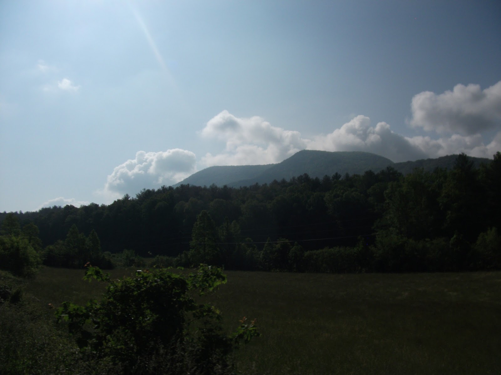
After Barnes Creek Falls, we continued up the ridge. We came to a curve in it, showing us the Cohutta Wilderness area sprawling out away from us. The Cohutta wilderness area is the largest one we passed through. The road we were on formed the edge of the wild, within which there were no roads, only a few hiking trails. The Cohutta becomes the Big Frog wilderness in Tennessee, and continues a vast distance.
We eventually arrived at Jacks River Fields, and claimed our campsite. We then went the 16 miles to the little town of Blue Ridge Georgia, to get supplies. We got a good bit of food and other things.
We then stopped and ate lunch at a restaurant.
We then returned to the campground, and set up the rest of our camp.
The campground is on a bend in the river. Supposedly the campground is named for a Cherokee named Jack who farmed the valley, and had a farmhouse on the site of one of the tent pads.
The sound of the rushing river was awesome.
We then hiked up to the South Fork Trail, after seeing a mark on the map representing a waterfall or rapid. A ways up the trail, we saw a smaller trail off through the woods. We assumed that something like a waterfall would be marked, but as it appears, they are so common out there that no one bothers to mention them.
And some more hiking pictures.
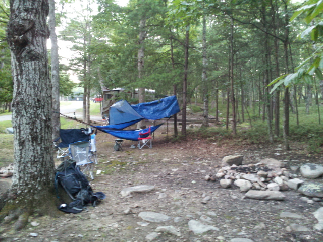
We then returned to camp for dinner. I had set up my hammock, and Dad had his tent.
We cooked some dinner, I had spaghetti.
We lit a fire with some found wood, in the little firepit.
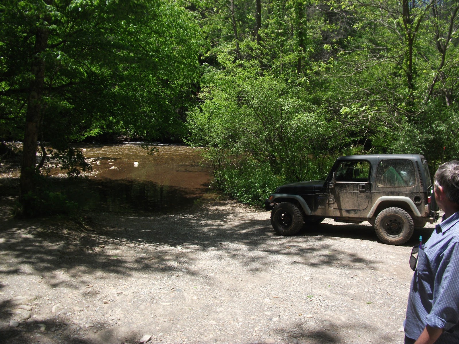
I refilled my water bottle using my new filter in Jacks River.
Before long, darkness fell. We went to bed and fell asleep to the sound of the rushing river.
The next morning, I awoke at first light, which was about 5:00. Thanks to the fact that we were in a valley, the actual sunrise was about 8. The valley we were in was at a high elevation, fairly close to the headwaters of South Fork Jacks River.
The river was very nice.
I had some grits for breakfast, and Dad ate some blueberries and cherries.
We regretfully began to pack up. We didn't want to leave.
The campground did have some amenities, a very clean vault style bathroom, (Maintained by a group of backcountry horsemen.)
and a bear proof trashcan. (with bullet holes.)
After leaving Jacks River, we proceeded down toward the valley that contains the town of Blue Ridge.
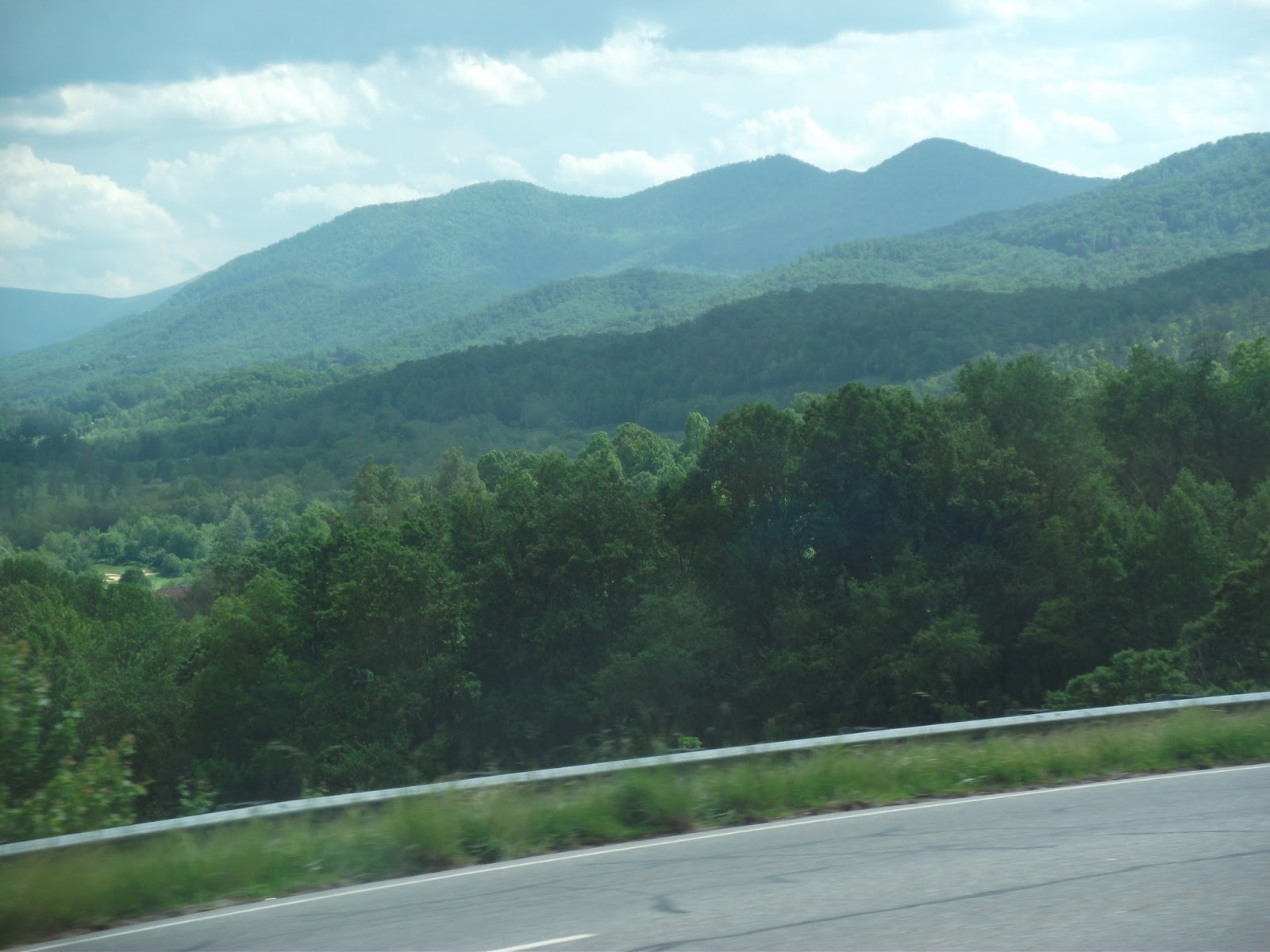
The road continued to yield awesome views. It wasn't a bad road, just a dirt one. It was long, and wild, without a doubt.
We came to an area with a cliff face, where we parked to arrange our gear.
After a stint of pavement, we came to the Rich Mountain WMA.
This road (153 on the map.) had some views as well, and some pleasant little mountain valleys.
We came to a nice little campground, on the banks of the Noontootla River. (FS 58)
We arrived too early in the day to camp here, but for future camping trips it would be nice.
We continued a ways down the road, seeing a number of other campers, until we came to a little waterfall.
We quickly realized that it was not a little waterfall at all, after seeing that it began a vast distance above us.
Dad had found a place where the Appalachian Trail crossed the road we were on and went to a waterfall, so we decided to hike that stretch.
The trail here followed what must have been an old logging road. The AT had white blazes.
This sign showed where the benton mckay trail separates from the AT, and was near the Long Creek falls spur went as well.
A short ways down that spur trail, we came to this waterfall.
Long Creek Falls
We set up our hammocks nearby and rested for a while.
We then hiked back to the road.
After this we wandered around the Toccoa valley for a while.
And we came to this bridge.
Luckily, there was a newer one just down the road.
After this, we headed up past Cooper Creek Scenic area, and the Mulky and Cooper Creek campgrounds, and went onto what the map said would be a bad road. (FS 39)
The maps uses two dotted lines to indicate bad roads, and that is what this one was.
We followed this road down for what seemed like a vast distance, largely due to our slow speed.
After a while on this road, we decided to find a spot to camp.
We found a little spur road going to a campsite near on a ridge near the mountain called Wildcat Knob, and decided to make camp there.
We began to hear distant thunder almost as soon as we arrived, but didn't think much of it at first.
This is Wildcat Knob.
The campsite was at the peak of a smaller mountain on the ridge, with the sides sloping down in all directions. It was a pretty epic spot.
We then began to set up camp.
We cooked dinner early, since we thought it may sprinkle.
I noticed that the ground level flora was different than ours at home. There weren't really any species I recognized on the forest floor area, except for some ferns. Even those looked different.
Much of the fauna was different too, these large snails seemed to be everywhere.
The sun's rays sliced through the forest.
It was a nice campsite, although not perfect for the events later that evening.
The sun was setting, and the thunder still hadn't gone away, but It was some distance Northwest of us, with the prevailing wind blowing it away. To the southeast, there was nothing but a few wispy clouds.
We didn't really know where we were, so Dad was trying to figure it out. Soon however, a boom of thunder came from the south, and almost immediately it started raining. The thunder started exploding around us like artillery shells.
We got in the Jeep, hoping to wait it out.
It didn't stop quickly though. Here are a couple of the many videos we made of the lightning. Pardon our comments.
Eventually, it got far enough away to where we decided to go to bed. It rained and thundered all night, but our shelters held out. We decided to call this hill "Thundertop," in honor of our experience. I had a pretty good way to sleep when its a little cool, but not cold. I slept on top of my sleeping bag, with my blanket on top of me. That way the sleeping bag made a more comfy underquilt, while my blanket made a top quilt. When its colder, I use a sleeping pad to insulate the bottom and sleep in my 20 degree mummy bag.
Everything was pretty wet when we woke up, but the storms had stopped. Looking back at it now, it was pretty epic night, weathering the storm though at the time it didn't seem quite so cool. But i'm proud that we stayed out all night, and didn't retreat to some town in the valley.
It was a pretty cool spot.
We then began to pack up. Not quite as regretfully as the time before, with more thunder booming.
More strange fauna.
I think this may be wild Ginger, and edible plant. Though the other samples of it looked a bit different.
Some glasses we found. We joked that it was all that was left of the previous campers after Sasquatch came. Broken glasses also had an element of foreshadowing.
After packing up, we headed down the road, perched precariously on the side of the mountain, down to Vogel State Park.
Vogel is a State Park built around Lake Trahlyta, which is in the background above.
Here is a map on the signpost at Vogel that shows Wildcat Knob.
We bought a few supplies in the store, refilled our water, and headed toward Brasstown Bald, the tallest mountain in Georgia.
The drive there was pretty, though mostly pavement. It was the first pavement we had seen in a good while.
We climbed the bulk of Brasstown Bald on paved roads in the Jeep. It was a steep road and a hard climb, but the Jeep was up to it.
The parking lot was in a little valley between two tall peaks. It was mostly empty on this day, though there was a college group.
There were two ways to the top, we could take the shuttle, or hike. We decided to take the shuttle up.
We saw a short movie about the different seasons on the mountain. Its high enough up to have very different weather then the area around it. The views were pretty incredible.
I got a picture of a red-tailed hawk on top.
We decided to hike down the mountain, through the "cloud forest." They call it that because it is over the cloud level at times.
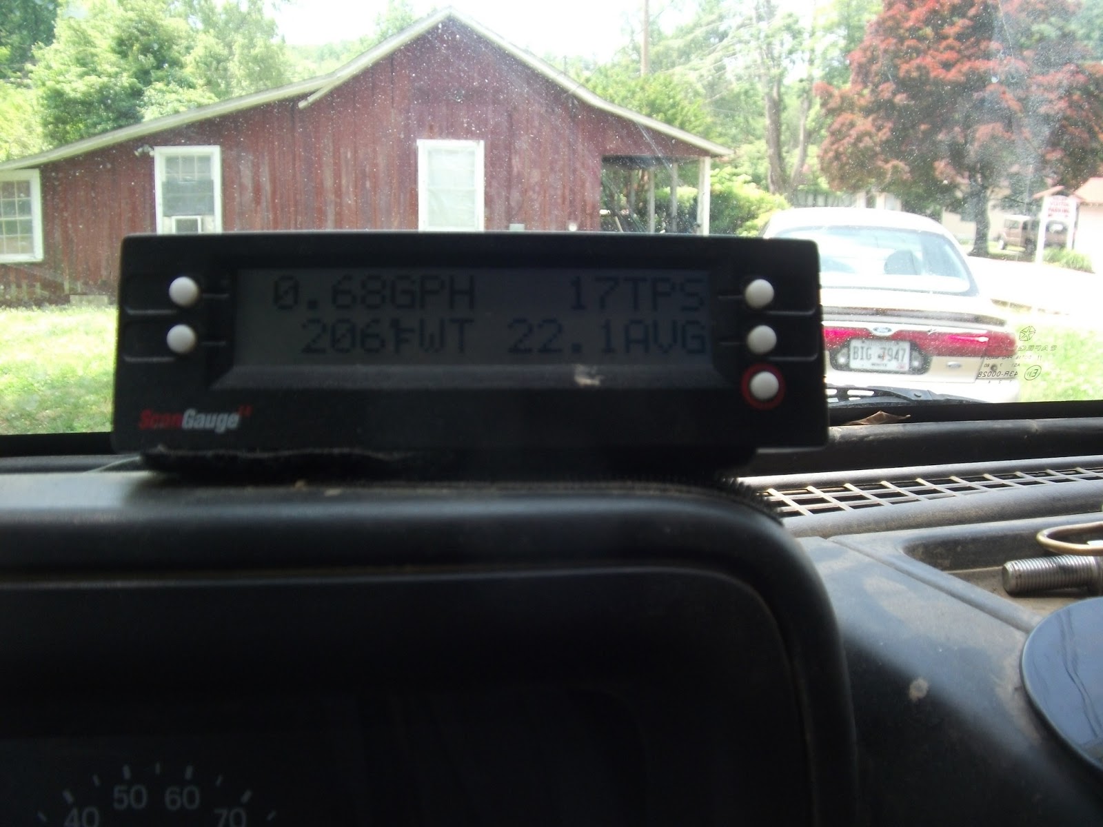
We began the treacherous, low gear drive down the mountain.
At the bottom, I could smell the brakes, but after that descent, brake smell is pretty normal. It was downhill enough for my ScanGauge to say I was getting 22mpg!
We then went to the nearby town of Helen for lunch. Helen is a Swiss or Germanic themed town, and we ate at the "Old Bavaria Inn."
I had a steak, the largest meal I had eaten the whole trip.
After that, we followed a dirt road along a river toward Tallulah Gorge State Park.
Soon, after getting a little lost, we arrived at the gorge. It was vastly larger than expected.
We entered the park, despite some confusing road signs, and hiked out to the overlooks.
It got more wild and more impressive as time went on.
We went to the visitors center, where they had fascinating exhibits on the several different ecosystems in the levels of the gorge.
It was impressive.
These were the Hemlocks we spent time in. They grow in moist, wet areas.
This is a tiny Komodo Dragon. I am joking, but I don't know what kind of lizard it is.
We then went North to Blackrock Mountain State Park.
We came to the top and went to the campground.
This is the store, but it was closed, so we had to find the campground host to check in. He was a nice man, and also sold us some dry firewood. Our campsites had a lot of poison oak, and it had recently rained, so firewood would have been unpleasant to gather.
It began to rain again, so we hid on the porch of the store.
It eventually passed, and we went back to the campsite. It was a pretty nice place, on the side of the mountain.
With it being dark, most of my pictures of the camp were the next morning. But that night we lit a fire, cooked dinner, and then hunkered down for the night, hearing more thunder.
Spaghetti again.
That night we were hit directly by the storm. Luckily it was coming from the other side of the mountain, so it wasn't windy. I did not get wet at all under my rainfly, despite driving rain.
The following morning, a low cloud had fallen over the mountain, reminding us of our altitude.
Once that cloud cleared, the sun came out and the weather turned pleasant.
It really was a good place to camp, despite the slick walk up the hill from the parking area.
The bird sounds were nice as well.
The abundance of poison oak is still the primary bad thing about this campsite.
It had showers, though the ranger said that lightning had struck the pump the day before, rendering them useless.
It was campsite H.
We soon had to pack up and leave.
We saw that there was a geocache down one of the park trails, so we decided to go find it.
This was the Tennessee Rock Trail, which led to the summit of Blackrock Mountain.
We found and logged the Geocache, and then headed back to the Jeep.
On the way back down, Dad realized he had lost his glasses. Luckily, they were at the entrance to the trail.
Rawr.
Blackrock Mountain is the tallest state park in Georgia, with several peaks over 3000 feet.
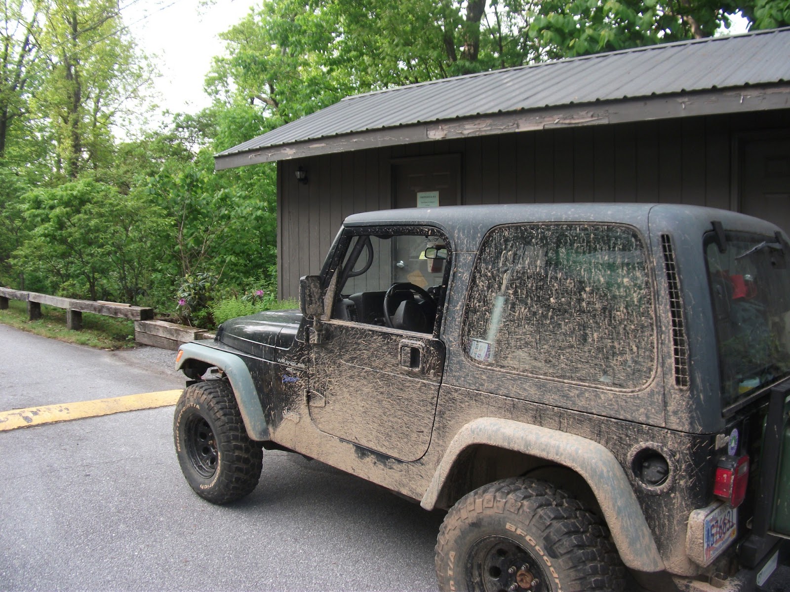
The Jeep really served us well this trip. It had no issues with space, or reliability.
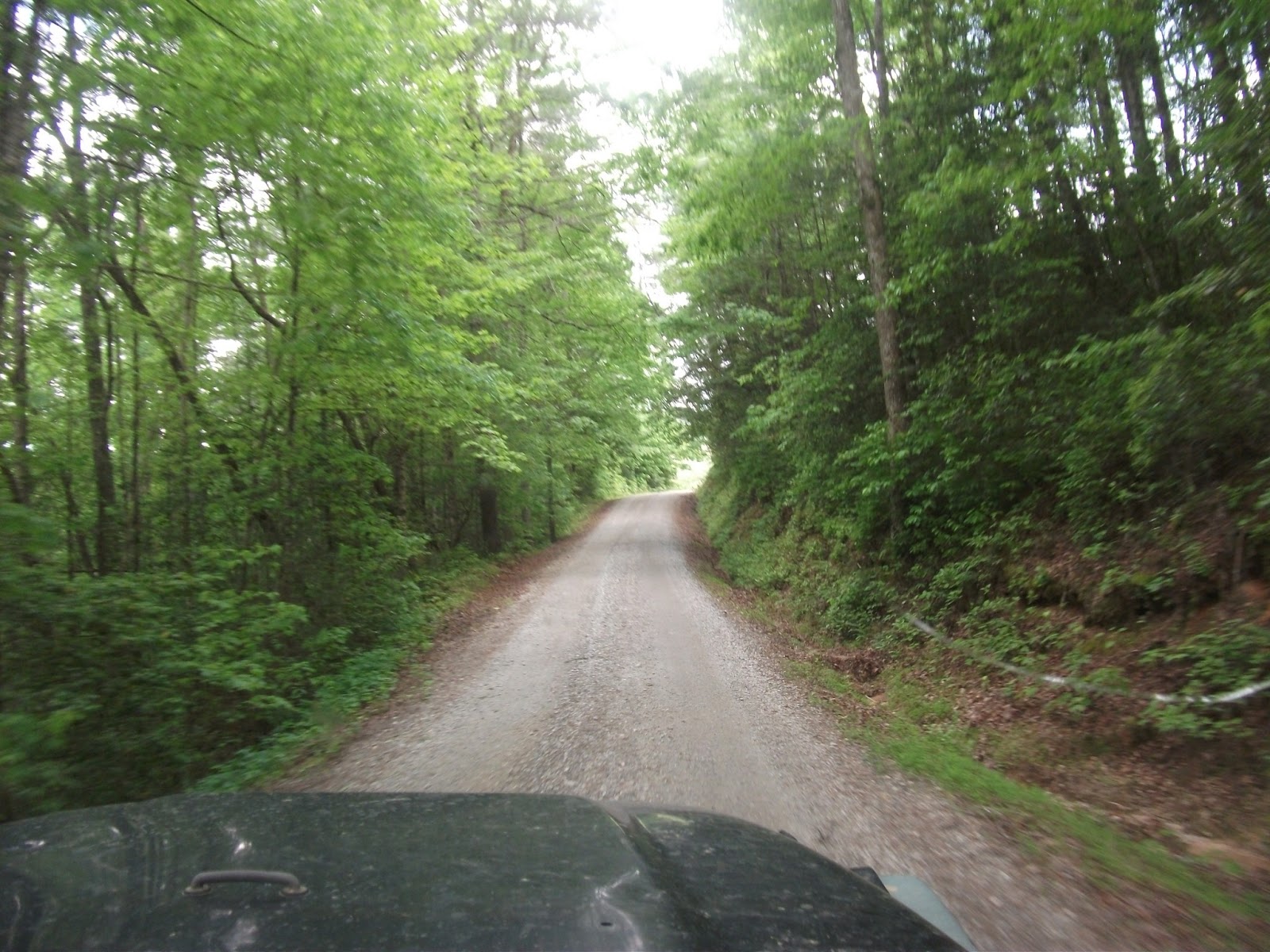
We left Blackrock by Forest service roads to the west, making our way home.
We saw a total of 5 states.
We didn't know it, but the road we chose followed the Tallulah river, and was beautiful.
We stopped and looked at the river in a place near a bridge.
We passed what looked like a boat ramp, and continued on. We came to a campground that was past our turn, so we turned back. We went back to the boat ramp, realizing that it was the only option to be the road. The road we were turning on was supposed to be "suitable for passenger cars," but the entrance to the road was a ford up 100 feet of the Tallulah River.
As you can see, it is a pretty good stretch of water. But the bottom was hard, smooth river stones, and it wasn't very deep. So we went for it. Dad said that towards the middle when it got deeper he "Began to question the wisdom of it," but we came out the other side without difficulty.
The road got worse (or better, if you like off-roading as much as me) from there, with deep, flexy ruts and more river crossings. We eventually came to another segment of the AT.
The road was mostly downhill from there, eventually turning back to pavement in a nice valley.
We then began to slowly wind our way home. By backroads.
Dad had found on an old civil war map where our Sproull ancestors had lived, and we decided to go see the place.
For our family who read this, the christmas couch in Grandmother's house was said to have been dragged out of this house and used to feed Yankee horses.
After this, we made the long, grueling drive back to our house. When we arrived there, we had a totally different view of the world than we left.
Well, that was our trip. It was incredibly fun. In the end, everything served to make it better. We climbed mountains, forded streams, witnessed unusual animals viewed massive canyons, weathered storms, followed rivers, and met interesting people. It was one of my favorite trips of all time.
Thank you Dad for going with me on my senior trip and being generally awesome. I am very grateful to have a father like you.