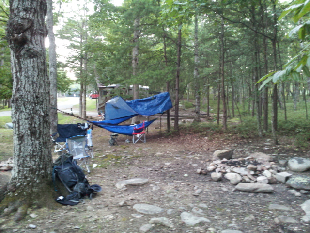
Showing posts with label Cheaha State Park. Show all posts

Monday, October 6, 2014

Autumn Cherry Trees

            We slipped out of life and into the wild again this weekend, my second week in a row. The weather was positively amazing; dry, clear, and cool. We went south-east of Munford to Cherry Tree Hunter's Camp.
             There was a fire ring of flat rocks under a thick pine and hardwood canopy, preventing thick underbrush from growing atop the smooth knoll upon which the campsite was located. The trees were spaced out far enough to be reminiscent of columns in a tall cathedral, complete with a vaulted ceiling and bright light shining through green "stained glass." There was a steady breeze which kept the area cool, and very few signs of humanity.
We set up our shelters, and gathered firewood. We decided to do without any artificial fire starters to prove to ourselves we haven't become too soft, so I piled some wood shavings and a touch of lint on a piece of bark and used a flint and steel to set it alight. I put the tinder under the kindling teepee, and soon we had a fire.
We managed to keep it quite large, and were able to cook on it.
There were three of us on this trip, myself, my father, and Mike.
        A fun group, with lots of jokes and good conversation.
For dinner, Father and Mike grilled hamburgers, while I made an aluminium foil packet meal of hamburger meat and green beans.

Mine was very good, and though I can't speak for the others, they didn't complain. (Much)


         We sat by the flickering flames for a time and talked. while talking, The orange firelight reflected off of the nearby trees. In the distance coyotes cried their piercing howl, and screech and Barred owls let loose their songs. The peaceful autumn evening-crickets sang around us as we became slowly more drowsy. Eventually the fire had settled down to a small flicker, and so had we.

       There was a faint blue light in the sky the following morning when I awoke, feeling the chill on my face. I untangled myself from my warm nest of sleeping bags and climbed down to the ground below. The morning air was chilly, and soundless. The night crickets had ceased their songs, and the day crickets had yet to begin. I put on my jacket and walked over to the fire ring. I stirred up the white dust to reveal heat below, and piled some pine straw and small twigs on the red coals. With a little bit of blowing, the straw caught and we had a fire again.
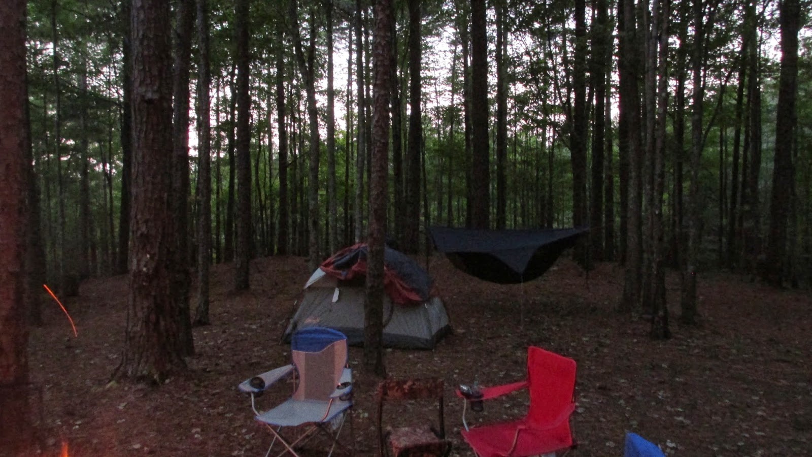
         It was still somewhat dark when father woke up, the dawn having not yet broken over the tall mountains to the east. We began to make breakfast and coffee on the fire, which I had let burn down to hot coals for cooking.
After hearing several reports of bears in the area, and seeing that the state park and forest service have begun to place " what to do in a bear encounter"signs around, I decided to hang our trash up, as opposed to the usual of putting in the car or just leaving it hanging low on a tree.

      I personally don't mind having black bears here as they are traditionally fairly reasonable animals. That being said, we will start having to take precautions to avoid a close encounter, though I wouldn't mind seeing one at a distance.

        After breakfast, we built the fire back up, never having to restart it fully after just some tinder and a flint the previous day, and watched the sunlight appear first in the upper reaches of the trees a hundred feet above us, and then slowly creep down to us.

 After our wood pile was largely depleted we decided to pack up our stuff and head off to find some lunch. We got everything in the Yukon and I went to crank it. I turned the key and it made a faint click, and the electric locks started locking and unlocking. We popped the hood, but nothing obvious was wrong. We decided the battery must have discharged for some reason, although we couldn't think of one. Nothing was plugged in,and I turned the dome lights off the night before (to save the battery).

As you can see, it was very stressful


      We called a number of people, but eventually Mom, Olivia, Zac, and Kristen came in Mom's Jeep and jumped us off. We then all went down the road and up the mountain to Cheaha State Park, where we ate lunch before going to Bald Rock.


Sunday, August 25, 2013

Bald Rock-CCC Road Hike

This last Saturday, Dad and I decided to hike from Bald Rock down to the CCC Road. On the map it claimed to be less than three miles.
We set out walking down the Bald Rock boardwalk, and then turned back east heading down the mountain.
The view from Bald Rock

About half a mile later, we hit the Pinhoti Trail, and turned northwest on it. The road where we had left the Jeep was only a few miles as the crow flies, but that distance is rarely similar to the actual walking distance. 
We stopped in a rocky area not far along to adjust our bags. 

Father had most of his stuff attached to the outside of a fairly small backpack, which worked, though not optimally. He carried a tent and an air mattress, as well as a fairly large sleeping bag. 
The area here was fairly nice, on a hump protruding off of Cheaha. 
 The occasional view would peak through the trees, though the intensive growth obscured most of the dramatic views. 
 The trail then began to follow the relatively flat ridgetop, which had thicker brush. 


We also noticed that the trail here was lined with a huge amount of Poison Oak. 
We continued along, stopping to check the map at times. 
The trail continued, often no more than a faint track winding along the side of the mountains, changing environments as we trekked along. There were more open areas with low shrubs and enormous, ancient trees, 
 and areas where the trail passed through fern filled gullies carved by small streams over the last couple millennia.
We left fairly late in the day, as we were planning on staying the night, and the sun began to get low in the sky. 

The GPS claimed that there was a "Spring Crossing" ahead, so we decided to aim for that as a campsite. When we arrived there, we found a small, bubbling stream emerging from within the earth, and a pleasant grove of trees. The spring was nestled in a little valley on the west side of the blue mountain ridge, with the late evening sun casting a red-orange glow on the area. In the middle, there was an enormous Longleaf pine tree that could have easily been 200 years old, based on its size. Since we had not seen any people, or any recent sign of people, we decided to camp close to the trail. The large pine tree had a flat place behind it large enough for Dad's tent, and I easily found a place to hang my hammock. 

Father and I both ate Mountain House freeze-dried meals, I had beef stroganoff and he had chicken and rice. 
We sat by the fire for a while, and then went to bed. 
 The following morning,we woke up around six. The sun had not yet risen over the sizable hill behind us, but there was a fair amount of light. 
  It was a rather nice campsite. 

We boiled some water and made some cheese grits for breakfast, and then began to pack up camp. 

As we hiked away from there, the trail continued to meander back and forth around more valleys, following the contour lines. 

For the first mile or two, there were deep gorges dropping off to the side of the trail, but the valley was slowly beginning to get closer as the trail slowly descended. Father and I commented on how the Pinhoti was a lot like an art museum, with each tree, rock, view, spider web, and even mushroom being like a different work of art, created by God and placed out there in the wild. 
Some of these trees were enormous. The area must not have been logged or otherwise affected by civilization for many years. 


 Eventually, the trail meandered down to the bottom of the valley, where the long-closed CCC road was. The Jeep was parked at the end of the open part of the road, about a mile from the Pinhoti. 

We walked down this lonely road, passing the hand-built rock arches placed by Civilian Conservation Coreists. After a fairly short ways, we came to the barriers placed in an attempt to keep vehicles out of this portion of road, and we saw the Jeep sitting there, unvandalized. (We were somewhat worried.) 
It was a great hike, fairly short, but really quite good. Everything worked well, and went more or less according to plan. We even managed to have a nice campfire. I always enjoy spending good time with Dad like this, and I always enjoy being in the wild. With there being no trailheads or significant landmarks for many miles in the direction we went, I suspect there are very few people who ever walk this part of the trail. We never did see another human, or even any real sign of humans. Nothing but a single cracker wrapper, which was tattered and ancient. I think the next section I wish do do is the valley between the CCC road and C.R. 24/ Morgan Lake. It'll be a long stretch, but a good one for the dry season with it being in such a wet area. At the beginning of this I mentioned that the map and the signs claimed that this hike was three miles, plus the one mile of CCC road. This is what my GPS said at the end. 
 I'm not sure what unit of measurement they use, I suppose they are just measuring as the crow flies... 


Sunday, August 4, 2013

McDill & Cave Creek Loop

After a long but great summer, I decided to go backpacking again. Clarence and I were going to do the Cave Creek loop again. I went Friday night to the top of Cheaha, where I met Mom and Dad and Clarence at the Upper Campground. It wasn't a bad campground, although the neighbors moved in at about 11:30 and weren't done setting up their tent and otherwise making noise until 2:00 in the morning. I slept fine anyway, so it wasn't bad. We all set up our hammocks.

The following day, around ten, we left for the trail. We went for the Pinhoti side first, since there was more water on the Cave Creek side where we would end up camping. I reset the trip on my GPS just after the trailhead to Pinhoti connector. Before long, we were underway. 


Dad went with us to Hernandez Peak, then turned back. He followed a service road back to civilization. Hernandez Peak was a pretty good climb up to a rocky peak only a couple hundred feet shorter than Cheaha. as we were walking along, the cliffs began to loom before us. 
 This is me at the bottom. The trail seems as though it's going to go around the cliffs, but then it turns and goes straight up them through a slightly lower pass.  


At the summit of Hernandez we stopped to rest a moment as the climb was tiring. 

Dad left us there, escaping before any pictures of him could be taken. Clarence and I continued on down the Pinhoti. 
The terrain became more rocky as it wound around the summit of McDill point. 
Soon, the views became more impressive. 
We stopped at McDill point for lunch. 
 I had canned salmon and some cookies I bought at the store on Cheaha.
 McDill point is down a spur trail leading to the actual point, which sticks off of the main mountain range, at the 2.57 mile mark.
 Looking back toward the main mountain range.
The trail looped back around the other side of McDill point, passing through some more boulders. 

A few miles later, we came to the connector to the Cave Creek trail. 
It jumped across the summit of a mountain. 
 The trail became more rocky over the ridge.
After hiking most of the way to Cave Creek, we took a short detour off the trail to get some water. It was a difficult slide down, going under brush and around trees. We did eventually make it to the bottom, where we got water out of a crystal clear, bubbling mountain stream. 


We walked up the a ways, until we decided to make the hundred vertical foot climb out of the valley. 
We followed the trail a little ways down, and then diverted off of it to the campsite that Dad and I camped at a few months ago. 

While it looks different now that its summer, It was still somewhat familiar. 
With rain on the horizon, and thunder rolling closer, we decided to eat. I had bought some Mountain House freeze-dried teriyaki chicken at Dick's before we left, and so I boiled some water in a emptied percolator pot.  

It actually tasted pretty good, I wasn't expecting much, but it smelled quite good. There was the occasional dehydrated crunch, but good overall. I used my Pocketrocket again, still worked well. 


The rain started not long after that, and didn't end until after dark. I ended up going to bed about eight, and waking up about eight the next morning. I did wake up a time or two during the night, being cold even though it was august. Some sort of insulation under you is good, even in summer. 
The next morning, I awoke to sunlight shining through the trees, and the sound of birds singing and bees buzzing. It was still cool at that time, though it was beginning to get muggy.

 There were two dry spots on the ground where our rain tarps covered. Clarence's was enormous, it covered what seemed like a square mile. In order to try to get out before it got hot again, we headed out early, right after breakfast. 

 The trail continued on, winding throughout the forest. The miles ticked by, and we got more tired. This side of the trail had adequate water, so that was nice. 
 My sawyer filter served me well on this trip. 

 The trail continued on, perched above the horse creek valley. Before long, we passed the large sinkhole from the last hiking trip, followed by the power line cut, and then the trailhead junction. 

As you can see, the we ended up at 11.22 miles. I'm pretty sure that 5.7 mph top speed is from when we were sliding down the hill, but I don't know. Our average speed was pretty good though, 2.2 mph. 
It was a really fun trip. I'm tired, sore, and itchy, but it was worth it. The forest is full of life this time of year, and many people miss out on it. It was somewhat uncomfortable, but it was still fun. 

  In the end, the (literally) hundreds of bug bites were well worth the hike. It was great, and I would do it again tomorrow. In fact, I may yet do that.